Satellites – remote sensing technology
- Location
- Japan
Nippon Koei has developed its own technology using remote sensing satellites to provide risk assessment, forecasting and monitoring services to clients.
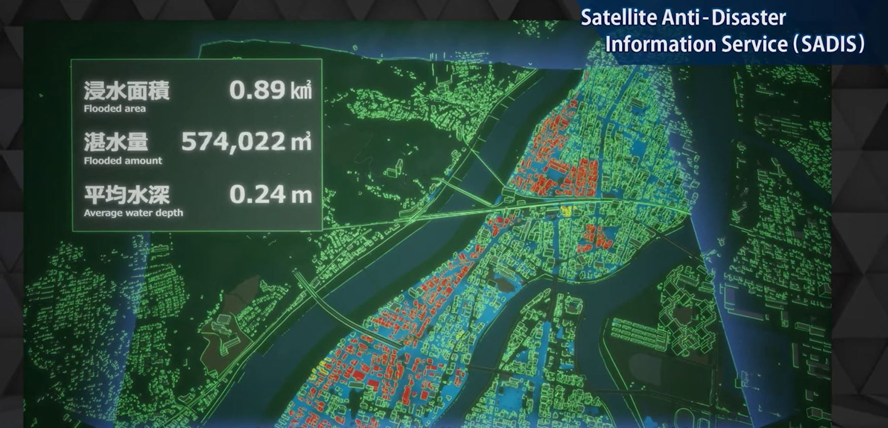
By combining highly accurate imagery with accumulated knowledge and data, we can provide services from detailed disaster analysis to monitoring. We specialise in the following areas:
- Flood inundation
- Landslide collapse
- Urban development
- Vegetation
- Slope change
- Infrastructure facility monitoring
We have partnered with QPS Research Institute, a Kyushu University venture that develops and launches small, lightweight, low-cost, and high-quality satellites. At present, the lead time from reservation to imaging has been significantly shortened, making it possible to take an image once every hour. In the future, Nippon Koei is aiming to launch 36 satellites to achieve a system capable of taking images at a pitch of once every 10 minutes.
Our satellite information services have formed business alliances with the top runners in various fields. The partnership with SKY Perfect JSAT Corporation promotes the development of image capture and analysis technology utilizing optical and SAR satellites. Meanwhile, Zenrin Co., Ltd. provides the residential map data, building polygons, and statistical information necessary for damage calculation.
For further information on our services, click here.