#{CategoryPrefix}#{Category}
#{Title}
#{Copy}
| Location | Client | Size | Completion |
|---|---|---|---|
| Gandhinagar, India | Indian Institute of Technology Gandhinagar | 163 hectares | 2011 |
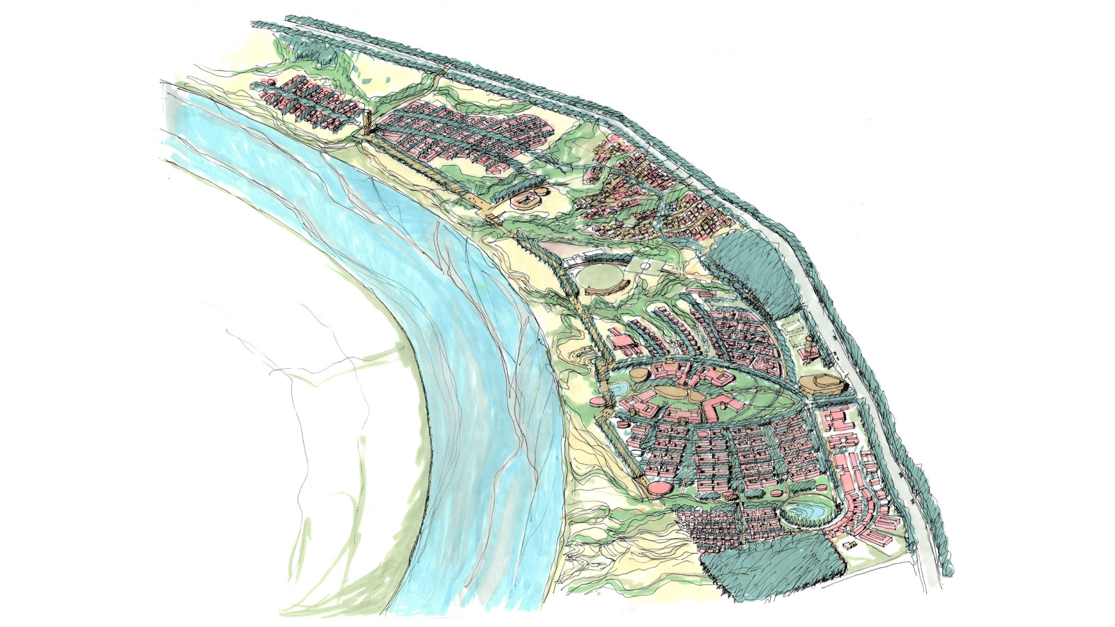
The Indian Institutes of Techonology (IIT) are prestigious universities in India and there is an increasing demand for their courses. Therefore, the objective of the Government of India is to expand in the coming years with new campuses. These new campuses are spread across the country and every campus is supervised by an existing campus established in the larger cities. The new campuses are often built in more remote areas, where they will, serve, besides training, also as a catalyst for new developments.
The site of the future Indian Institute of Technology in Gandhinagar lies on the Sabarmati River. A special landscape feature of the site are ravines, which feed water from the higher areas inland to the lower lying Sabarmati River. The undulating nature of the landscape limits the buildability of the site to areas of flatter land between the ravines. The proposal enriches the existing ravines with a series of new ravines. A system of parks within the ravines, accentuate the unique landscape and form a sustainable basis for the new settlement. On the West side, along the Sabarmati River, a new element in the form of a linear, shaded Pedestrian Riverfront Route is introduced which links the northern and southern halves of the site, including the series of “development pockets” between the ravines.
The Central Academic Hub is located in the southern part of the site, fronting a newly created park. The Academic Hub is announced on the Eastern Access Road by the Auditorium, and ends on the western side on the Riverfront pedestrian link where the Library is situated. Besides the Library, other communal amenities, used by many on the campus, such as the central sports facilities, Student Activity Centre, bank and shopping facilities, etc, are also located along the Riverfront Pedestrian Route.
Vehicular traffic is restricted to the flatter areas on the East of the site, where the rest of the built programme is located and which are more easily negotiable for vehicles. In this way the confrontation with the pedestrian network, which is mainly on the west side, in the park system, is avoided to a great extent.
masterplanning